Restoration Following the Re-Watering of Little Bear Slough
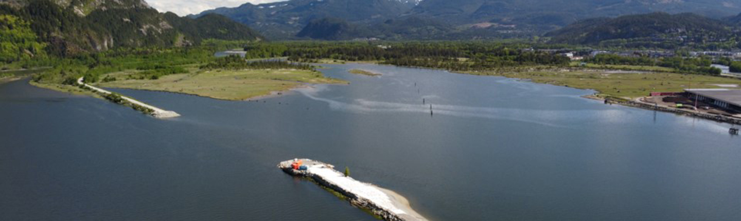
Little Bear Slough in the Squamish River Estuary has been disconnected from the Squamish River Estuary for 50 years due to a railway line and tidal flap gates.
The goal of this Seed Grant project, which will occur on traditional and contemporary territory of the Squamish Nation, is to map the extent of re-watering using topographic data and conduct in-depth species inventory to inform and develop a restoration plan for fish and wildlife species.
Executive Summary
Little Bear Slough (LBS) is located in the Squamish River Estuary on the traditional and contemporary territory of the Squamish Nation. Historically, LBS was connected to the Squamish Estuary; however, it has been isolated for over 50 years due to the installation of a railway spur line and two tidal flap gates. Plans are in place to re-water the slough via culverts in
the railway spur line beginning in 2026.
This seed project has successfully enabled documentation of the current ecological condition of the Nature Trust of BC’s (NTBC) Squamish Estuary Conservation Area, with particular attention paid to habitat features that support fish and wildlife. Surveys completed include: riparian vegetation inventory, water quality monitoring, wildlife trees surveys, and assessment of channel characteristics for fish habitat suitability. This data has been used to support restoration and project planning in the Squamish Estuary Conservation Area.
Priority restoration and enhancement activities have begun at NTBC’s conservation area, including invasive species removal from riparian vegetation zones and re-planting of native
shrubs. Further knowledge gaps and opportunities for habitat improvement have been identified, with recommendations for continued ecological monitoring with focus on current fish and wildlife presence and use within remnant channels, particularly pacific salmon. The implementation of enhancement and monitoring projects will be continued in 2025.
The project has completed work in line with several actions in the Cheakamus Watershed Action Plan including inventory and assessment of wetland and riparian areas as part of a restoration project (CMS.WAR.HB.26.01), as well as initial surveys to prepare for inform planning for restoration of cavities for large cavity users (CMS.UAD.HB.24.01).
Click the provincial database link below to read the full final report for this project.