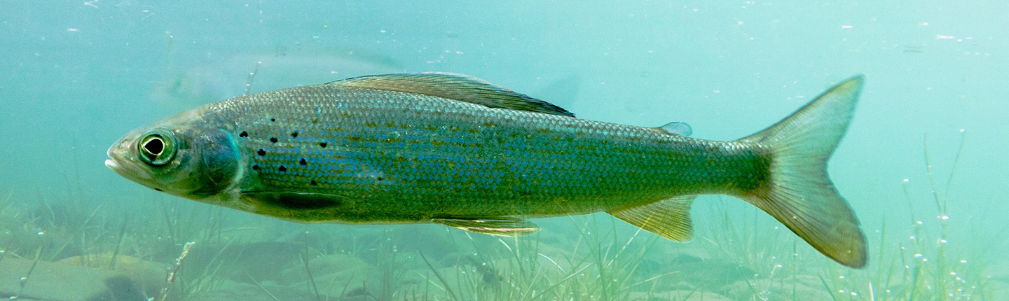
Update: Arctic Grayling abundance could be trending upwards
2018 snorkelling counts of Arctic Grayling in long-term index sections of the Parsnip River Watershed were the highest on record for five of the six sites surveyed (all but the lowest Anzac River site between 16 km – 12 km; measured along the stream from the mouth). Analysis of population trends indicate a significant increase in the abundance of Arctic Grayling: greater than 20 cm in index sites over the 1995-2018 period. This apparent positive trend is considered provisional and requires corroboration in 2019 and beyond, given the abundance data are not balanced across time, and there is uncertainty about whether the extreme low water conditions observed in August 2018 may have affected counts of Arctic Grayling. The urgency for habitat conservation and restoration actions is high in critical Arctic Grayling rearing habitat of the Parsnip River Watershed, given this habitat lies adjacent to the existing road network, where intensive forestry and roadbuilding activity is now underway.
Parsnip watershed Arctic Grayling monitoring
This project will resume Arctic Grayling abundance monitoring in the Anzac and Table rivers, which were surveyed from 1995-2004, using snorkelling surveys. This project will use snorkelling surveys to describe the distribution of critical Arctic Grayling habitats and abundance in the Missinka River watershed for the first time. Resulting monitoring data will address two major information gaps identified within the FWCP’s Arctic Grayling synthesis and monitoring framework documents: 1) the lack of Arctic Grayling abundance monitoring since 2007, and 2) poor understanding of Arctic Grayling abundance and critical habitats in areas upstream of the Table River. These data are required to assess conservation status, identify locations for conservation or enhancement actions, and identify new opportunities for human use of fish.
Final Report: Executive Summary
Two high-priority knowledge gaps have been identified by the Peace Region Fish and Wildlife Compensation Program (FWCP) that limit the program’s ability to initiate conservation and enhancement actions for Arctic Grayling of the Parsnip River watershed. These are: 1) the lack of recent abundance monitoring indicating population trend and total adult population size, key indicators of conservation status, and 2) the lack of monitoring data delineating critical habitats, which is needed for planning conservation and enhancement actions. In this study we address these two information gaps using a snorkelling survey methodology in the Anzac and Table river watersheds, thereby aligning the study with FWCP Streams Action Plan (FWCP 2014a) priority action 1b-3:
Action 1b-3: Undertake Arctic Grayling monitoring as per recommendations of the monitoring program and develop specific, prioritized recommendations for habitat-based actions which correspond to the monitoring results.
Click the provincial database link below to read the full final report for this project.