Mitigating Wildlife Migration Barriers
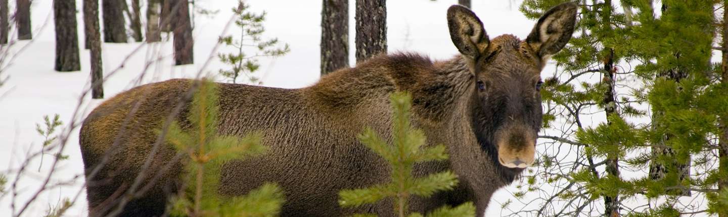
Hydroelectric dams in FWCP’s Peace Region have displaced ungulates and carnivores from their habitat to areas that have busy roads, such as Highway 97, which increases mortality through wildlife-vehicle collisions, and creates physical and genetic discontinuity as some wildlife start to avoid the roads altogether. Initial Y2Y-commissioned research has highlighted the urgent need to map collision hotspots and recommend mitigations based on sound science. This project will collate and supplement available data, and provide robust analysis to establish a case for, and to promote and inform potential mitigations, with the ultimate aim of restoring habitat connectivity and improving the health, movement ability, survival and sustainability of species, including Woodland Caribou, moose and Grizzly Bears.
This project will seek to restore connectivity in the Peace Basin, which has been heavily disrupted by hydroelectric reservoirs and related construction, by identifying hotspots of wildlife-vehicle collisions and potential collisions, and making recommendations for cost-effective mitigation solutions. This project will improve understanding of wildlife crossing and movement corridors along Highway 97 and through the Pine Pass, which will inform and increase knowledge of both collision mitigation and connectivity research, as well as carnivore and species at-risk management. Wildlife vehicle collisions along major highways in the Peace Basin are a contributing factor in the decline of species at-risk in the region, including caribou and moose. A comprehensive dataset detailing wildlife crossing sites and corridors, and proposed mitigation measures will work towards conserving at-risk species in the region.
Reducing wildlife vehicle collisions
With FWCP funding, the Yellowstone to Yukon Conservation Initiative Foundation (Y2Y) has assembled a research team, involving the BC Conservation Foundation, University of Northern B.C., and First Nations, to develop recommendations to reduce wildlife road mortality. Their task is to identify wildlife-vehicle collision problem areas along highways and recommend cost-effective solutions.
“There are two broad methods for reducing wildlife-vehicle collisions,” says Y2Y project lead, Tim Burkhart. “One is to change driver behaviour and the other is to change animal behaviour. It is generally more effective to do the latter, although a mixture of the two will likely achieve the best results.”
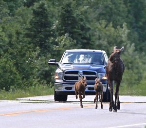
The team identified 17 hotspots – areas with a high frequency of collisions involving wildlife – on highways – #97 and #29. Six moose, five deer, three elk, one bear and other species were involved in collisions at these hotspots; only one had wildlife warning signs for drivers.
“Right now, motorists enter these sites without any warning that it is a hotspot,” says Dr. Roy Rea of UNBC. “Sign placement should reflect current data trends.” Improving signage or implementing speed restrictions are just part of the solution.
The northern landscape has been influenced by a wide variety of human impacts, including road construction and reservoir creation. Barriers like these can create “islands” of wildlife. These islands typically exist in wilderness or protected areas. Maintaining connectivity between populations – by creating safer passage for wildlife around and across highways – is key to generating and maintaining biodiversity.
The research team is working with the Ministry of Transportation and Infrastructure to install warning signs for each hotspot. Other recommendations include controlling mineral licks, brushing to improve sightlines and removing food availability.
Final Report: Executive Summary
Maintaining connectivity for the many native wildlife species that rely on the Peace region to travel along the Rocky Mountain corridor, which connects the Rocky Mountain Park system with the Muskwa-Kechika Management Area to the north, is crucial for their preservation and well-being and aligns with the FWCP Species of Interest Action Plan. Specific actions are to restore function of ungulate range by enhancing connectivity, identify limiting factors (collisions) affecting moose populations/other important ungulate populations and make recommendations to conduct habitat enhancement to benefit moose, elk, and deer populations through the mitigation of roadside attractants that result in collisions, and highway design/management that can result in fewer collisions. If wildlife cannot connect to other populations it limits their genetic diversity, which will lead to long-term population decline.
Highways and resource roads in the Peace River Valley run through important ungulate and carnivore habitat that has been curtailed by hydroelectric dam construction and impoundments. Species displaced by the reservoirs have had to move to other habitats, many of which are transected by roads or highways, further disrupting connectivity and habitat linkages.
Two areas identified as particular challenges to maintaining wildlife connectivity within the basin affected by dam construction and impoundments, are the Highway 29 and Highway 97 transportation corridors. Along these highways, woodland caribou, elk, moose, white-tailed deer, mule deer, grizzly and black bear, and fisher suffer mortality due to wildlife-vehicle collisions (WVCs) and/or they avoid the roads altogether, creating physical and genetic discontinuities between populations.
Yet data about collisions – data that would help to design modifications to reduce mortality for vulnerable species, increase the availability of habitat for use and travel, and improve safety for motorists – is widely dispersed and has not been rigorously analyzed to identify spatial and temporal collision trends.
Click the provincial database link below to read the full final report for this project.