Deer Creek Drawdown Zone Fish Habitat Enhancement: Year 2
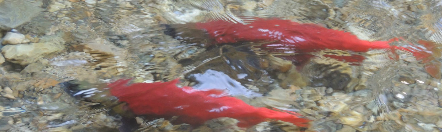
Deer Creek is within the drawdown zone and has been identified as having a limiting availability of deep pools and spawning substrate for Kokanee (Oncorhynchus nerka), the goals of this project are to enhance and improve fish habitat in Deer Creek, especially in the drawdown zone as affected by water management on Arrow Lakes Reservoir. Improving these habitat structures will benefit Kokanee by increasing cover and channel stability, and connectivity with Lower Arrow Lake at varying reservoir levels.
With the addition of more fish habitat structures in the drawdown zone section of Deer Creek, the channel will have increased connectivity to the Lower Arrow Lake enabling Kokanee to access spawning areas upstream. Structures also provide cover and resting areas for both spawning and young, rearing Kokanee, and increase the complexity and diversity of flows in the creek, in addition to helping maintain a channel into the Lower Arrow Lake to withstand fluctuation in reservoir levels.
Final Report: Executive Summary
Deer Park is a small community approximately 30 km northwest of Castlegar, British Columbia. Deer Creek flows through Deer Park into the Lower Arrow Lakes Reservoir, which is regulated by the downstream Hugh L. Keenleyside Dam (HLK) and upstream Revelstoke Dam (REV). When reservoir levels drop, the lower section of Deer Creek is exposed in the drawdown zone and has little cover for spawning Kokanee (Oncorhynchus nerka) and resident Rainbow Trout (Oncorhynchus mykiss). Low water levels also create diffuse, shallow water conditions through the drawdown zone, impeding fish migration. As a result, Kokanee are vulnerable to predation. Past efforts have focused on improving fish migration well upstream of the drawdown zone by removing obstacles impeding access (e.g., a relic WSC weir and Deer Park resident’s waterline intake weir). However, prior to Phase I of this project no work had been conducted in the drawdown zone.
The primary goal, adding in-stream cover and increasing water depth from the end of Phase I works downstream 100 m to an old bridge cribbing, included objectives to create: (1) stable wood and rock structures that would provide cover for migrating Kokanee and other inhabiting fish, and (2) a defined single channel to increase water depth and reduce the potential for channel braiding. The second Goal, to monitor the effectiveness of enhancement structures implemented in Phase II, included objectives: (1) to develop a map of pre-enhancement conditions and post-enhancement conditions, (2) to conduct post-freshet and post reservoir infilling, georeferenced stability assessments of structures in 2017, and (3) observe Kokanee use in the treated section (Phases I and II).
Click the provincial database link below to read the full final report for this project.