Seton River Corridor Conservation Restoration Project Phase 4
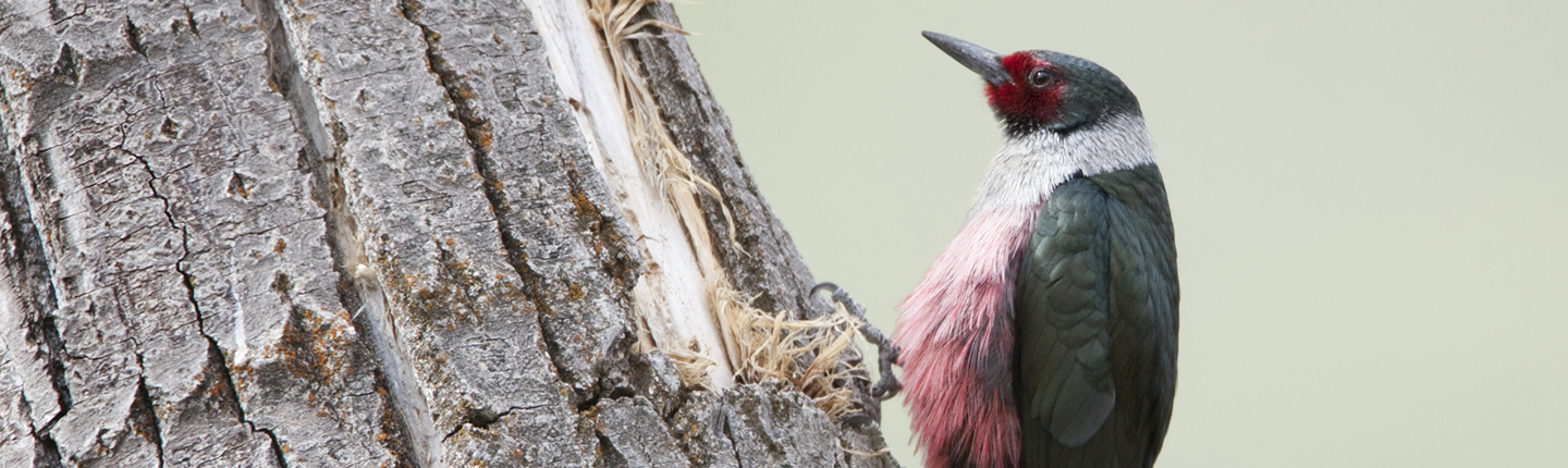
This project engages disparate stakeholders to facilitate the development and implementation of a Seton River Corridor Conservation and Restoration Plan, with the aim of enhancing and increasing valuable habitat for fish and wildlife, with a focus on species-at-risk. During Phase Four, information collected over the last three years and the current field season will be compiled for presentation to the partners (Sekw’el’was and T’it’qet) for their recommendations. Input from the 40+ stakeholders will then be sought during workshops and networking events. Following this consultation, a final working plan will be completed for approval. Field work will continue, including ongoing spawning channel, vegetation and wildlife surveys, restoration work and stewardship activities. Species that will benefit include: Coho, Chinook, Steelhead, Rainbow Trout, Interior Western Screech-owl, Lewis’s Woodpecker, Yellow-bellied Racer, Great Basin Gopher Snake, Rubber Boa, Spotted Bat, Townsend’s Big-eared Bat, and Mule Deer. Seton River Corridor Conservation, Restoration and Operational Management Plan will be completed with the consensus of the partners and stakeholders.
Recommendations provided in the plan will guide future actions on 798 hectares of land within the corridor by:
- identifying opportunities to secure Category 1 areas (or off-site areas to mitigate loss) that have high fish/wildlife values;
- determining future threats and potential mitigation strategies to protect Category 1 areas;
- identifying opportunities for restoration/creation of Category 2 areas (areas that could provide high fish/wildlife values with enhancement work);
- creating operational strategies for Category 3 areas (industrial/recreational lands); and
- identifying strategies to create wildlife corridors between Category 1 and 2 lands.
During 2016, restoration work will be completed on 2,145 square metres of land at the Upper Seton River Spawning Channel and 1,000 square metres in the lower corridor; invasive weed species at both Seton River channels will be decreased; and management prescriptions for Cayoosh Creek Spawning Channel will be developed after survey work has been completed.
This project will provide valuable information about past restoration and revegetation activities through a comprehensive monitoring program in partnership with Thompson Rivers University, where research will be undertaken to determine factors that influence success/failure of bioengineering and other revegetation works that can be extrapolated across the St’at’imc Territory in relation to site analysis and probability success. In conjunction with this work, a carbon sequestration research project will be initiated to evaluate carbon sequestration via biomass and soil into the ecosystem, and estimate potential sequestration opportunities at other possible restoration sites.
This project will engage up to 800 people at three community events and stewardship days, thereby building on the previous environmental education from the last several years.
Final Report: Executive Summary
The Seton River Corridor is located within the traditional territories of the St’at’imc who have lived and worked in the region for thousands of years. The Seton River, which flows out of Seton Lake, is approximately 4.7 km long and joins the Fraser River just south of the town of Lillooet. The Seton River and the land within the corridor have been directly impacted by the Bridge/Seton hydroelectric system, as well as transportation, forestry, urban development and recreational activities. These impacts are quite extensive; however, the area still has significant fish and wildlife values. The intent of this long-term project is to identify conservation, restoration and sustainable management areas within the Seton River Corridor, and develop wildlife corridors between high value habitats. The goal is to create a more diverse and healthy habitat for fish and wildlife, while taking into account all the human influences on the landscape. Habitat, vegetation and wildlife surveys have been undertaken throughout the corridor since 2010 to inform the planning process.
Click the provincial database link below to read the full final report for this project.