Foreshore Inventory Mapping for Aquatic Species at Risk
The Foreshore Inventory Mapping for Aquatic Species at Risk project, led by Living Lakes Canada, will evaluate and apply revised Foreshore Inventory Mapping (FIM) standards and methodologies drafted in March 2002 to ensure the long-term credibility of the methods, consider the various types of lakes to be assessed (e.g., regulated, natural, mountain ecosystem, boreal forest ecosystem, etc.), and provide a benchmark by which to compare habitat changes over time. The revised methodology will be applied to priority lakes as new or re-FIM projects, assessing the rate of change of shoreline health.
Update: High-priority lakes mapped to benefit at-risk aquatic species
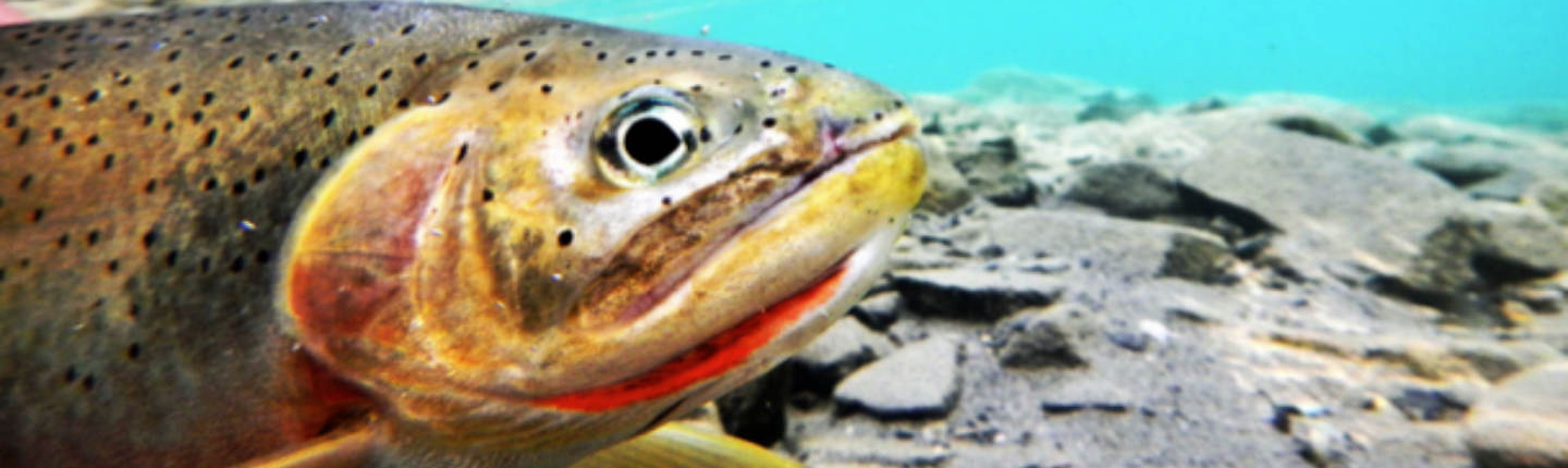
Foreshore inventories, maps, and development guidance documents for four East Kootenay lakes have been completed. Together, they will help conserve habitat and mitigate threats for several species, including the Kootenay River white sturgeon, Columbia and shorthead sculpin, westslope cutthroat trout, and bull trout.
The shoreline health of each of the high priority lakes—Whitetail Lake, Whiteswan Lake, Moyie Lake, and Lake Windermere—was assessed to examine the cumulative impacts of development. Areas were identified for restoration and high-value habitats were recommended for protection.
This ongoing project, led by Living Lakes Canada with funding from the FWCP, includes guidelines for foreshore development for each of the four lakes. As of October 2021, three additional lakes—Kootenay Lake, Slocan Lake, and Columbia Lake—have been inventoried, and reports will be completed in 2022.
This project aligns with a priority action in our Columbia Region Small Lakes Action Plan to help ensure existing natural habitats are protected and support the successful reintroduction of some at-risk species.
Final report: executive summary
Living Lakes Canada (LLC) is pleased to provide the 2020 – 21 Final Report for the “Foreshore Inventory Mapping for Aquatic Species at Risk” Project. Foreshore Inventory Mapping (FIM) is a methodology developed in 2002 in partnership with Fisheries and Oceans Canada (DFO). It maps foreshore habitats, assesses habitat value and establishes Foreshore Development Guidelines to conserve ecosystems and species of conservation concern. The project will evaluate and apply revised FIM standards and methodologies drafted in March 2020 to ensure the long-term credibility of the methods, consider the various types of lakes to be assessed (regulated, natural, mountain ecosystem, boreal forest ecosystem, etc.) and provide a benchmark by which to compare habitat changes over time. The revised methodology will be applied to priority lakes as new or re-FIM projects, assessing the rate of change of shoreline health. This project aligns with the Small Lakes Action Plan through the conservation and restoration of shallow water habitats and fish and wildlife species’ habitat. By determining cumulative development impacts along the shoreline, assessing and classifying habitat value, directing shoreline development to protect high value habitats, and identifying areas suitable for restoration, the Foreshore Inventory Mapping for Aquatic Species at Risk Project has benefited the foreshore and littoral habitats of four high priority lakes in the Columbia Basin.
Click the provincial database link below to read the full final report for this project.